Thousands of Randolph residents live within walking distance of the Blue Hills Reservation, but even some close neighbors don't realize how close they live. That's because there are few signs, no "Welcome to the Blue Hills" announcement, lots of "No Parking" signs and blocked entrances -- all leading Randolph residents to stay out for decades. People from the DCR, the Department of Conservation and Recreation, have never listened to the people of Randolph. And people from Milton and Canton and other wealthy communities treat the Blue Hills like a private park -- but in fact it's a PUBLIC park, and we are part of the public!
How do we fix this? One entrance at a time -- we can add signs and parking places and park entrances ourselves -- this page is the plan. We can grant ourselves access to one of the best recreational resources on the South Shore -- since our wealthy neighbors and the DCR have denied us access for decades. DCR refuses Randolph our fair share of our state park -- but we can work around them!
The Friends of the Blue Hills (FBH) is an advocacy organization that has been working with Councilor Gordon to open up the Randolph sections of the Blue Hills. DCR does listen to FBH -- they prefer organizations to individuals or municipal officials. The FBH has made an arrangement with DCR to maintain the hiking trails in the Blue Hills. FBH has an Adopt-a-Trail program -- Councilor Gordon has adopted the four "spur trails" that border the Deer Park neighborhood in Randolph. The goal is that FBH maintains these entrances on the Blue Hills side, and the Town of Randolph picks up on the town side. We can start with these four entrances, and then move on to more.
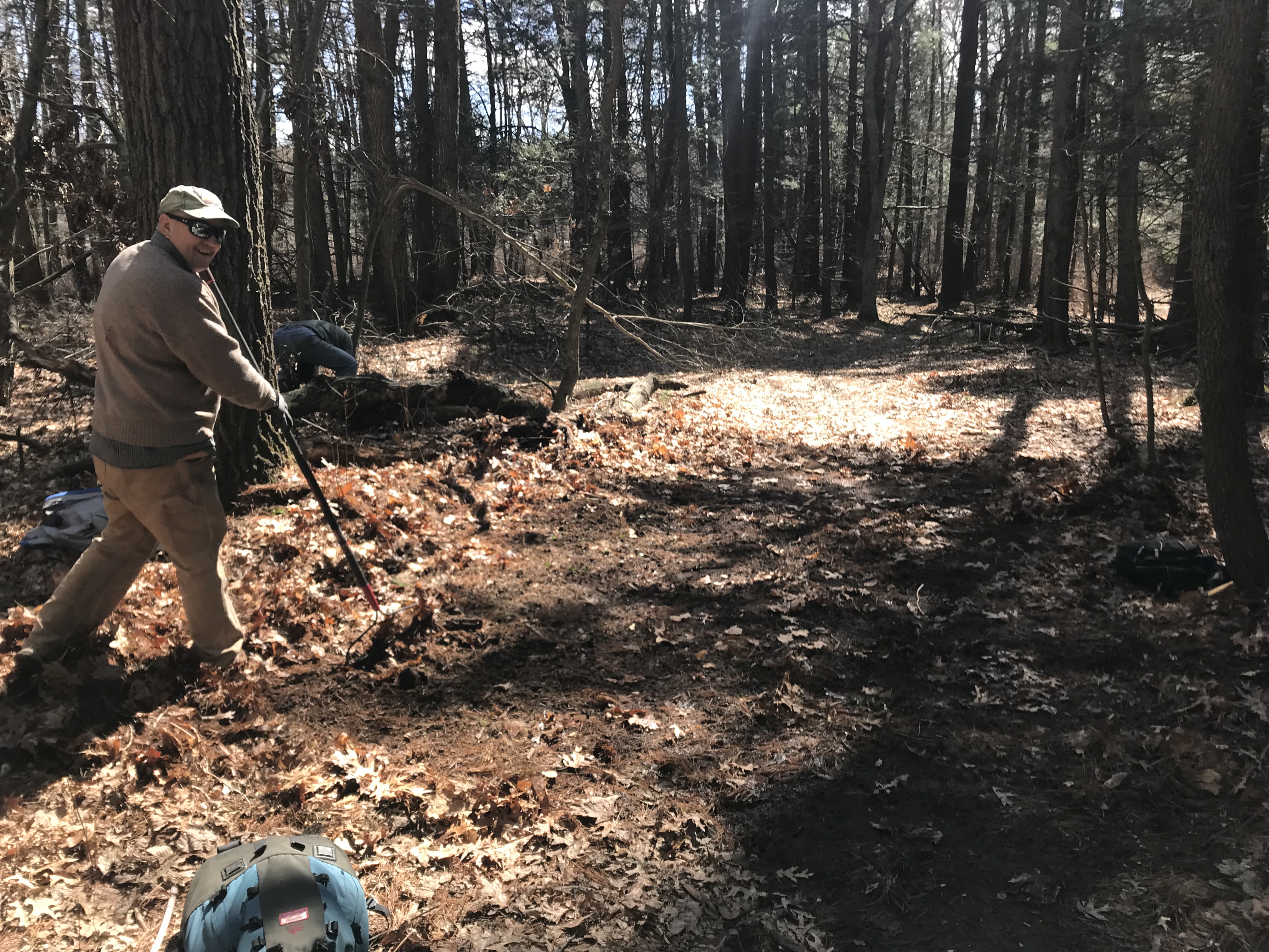
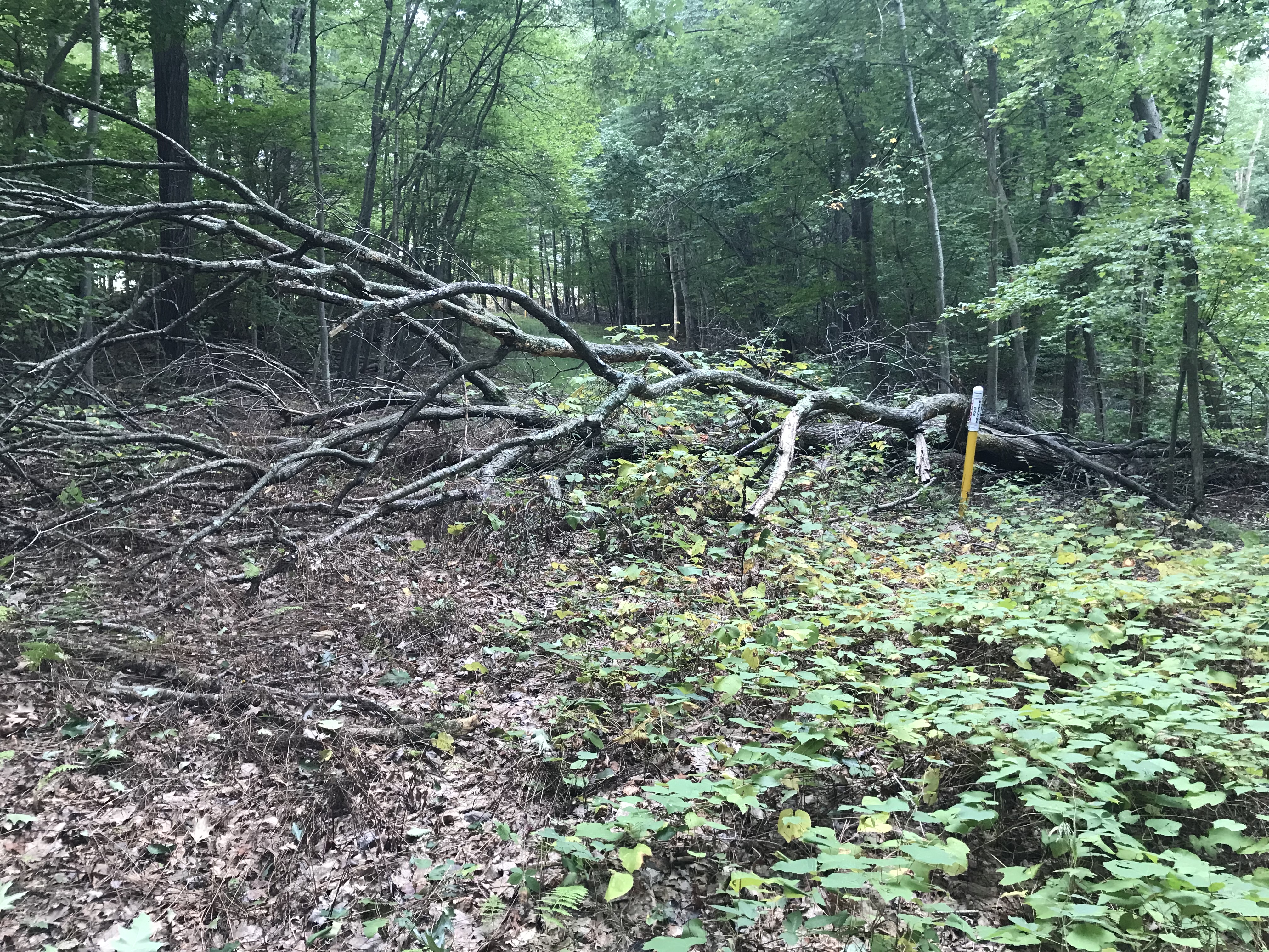
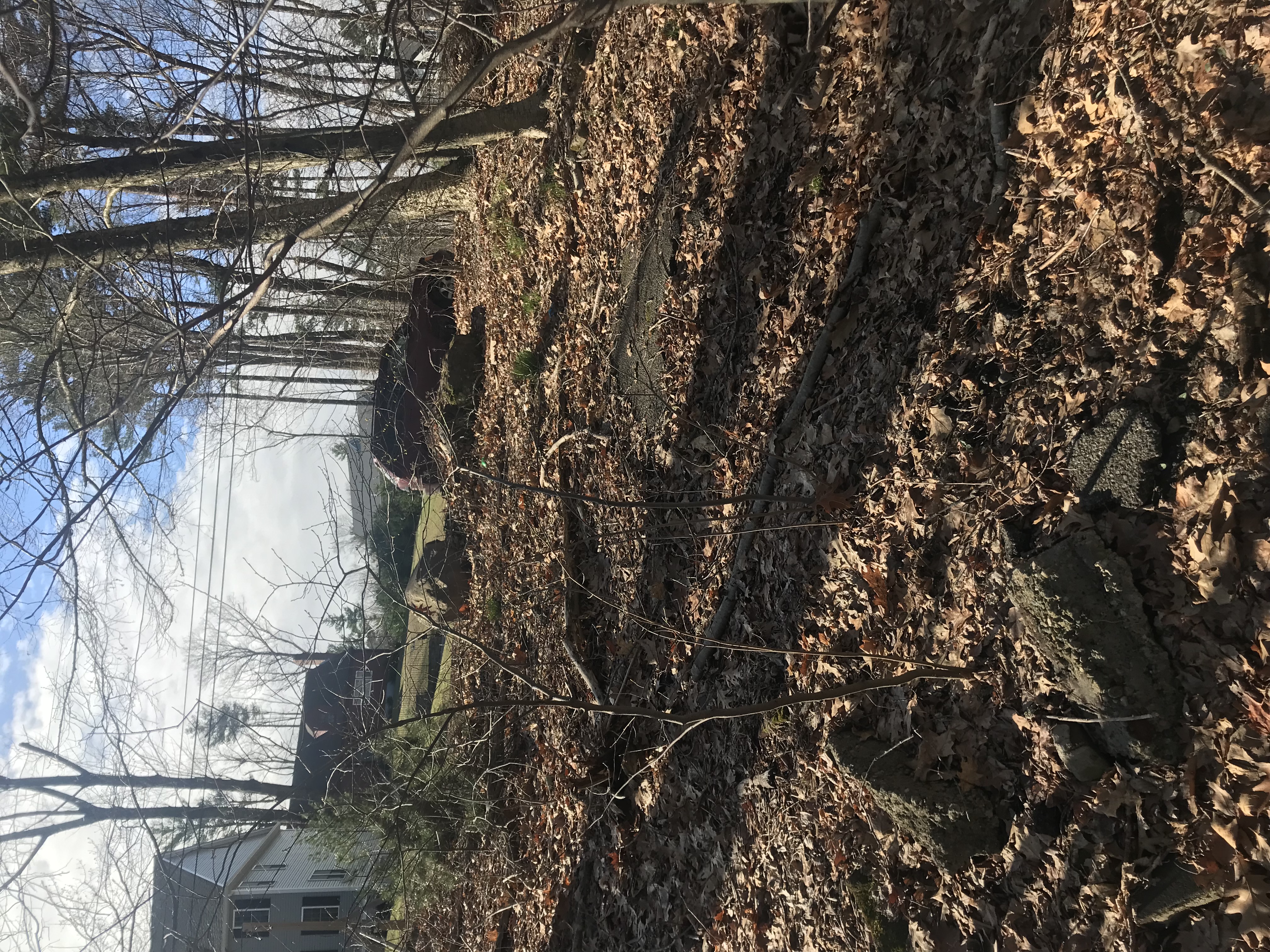
Here is how FBH trail maintenance works -- this one is on "Hemlock Road", just north of Turner Drive in Deer Park. FBH provides tools (and volunteers if needed -- it took three of us to move some heavy trees here!). You look around to see what needs doing -- like fallen trees blocking the trail, or growth from the sides blocking the footpath, or water damage that can be remediated -- and you fix it then file a "work report". The FBH has training sessions to teach you the ropes. Here, a tree fell over the trail, knocking down some smaller trees, and we had to saw through several trunks and then drag the pieces off to the side. It took about 20 minutes.
Councilor Gordon "adopted" this set of trails via the Friends of the Blue Hills' Adopt-a-Trail program, so they could be connected to the Randolph neighborhoods and allow access on foot or bicycle.
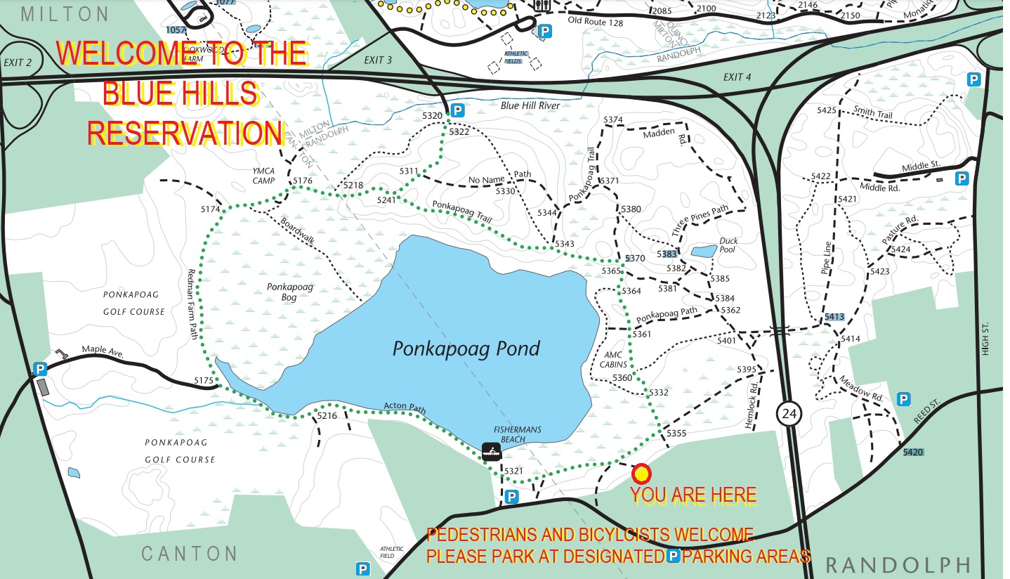
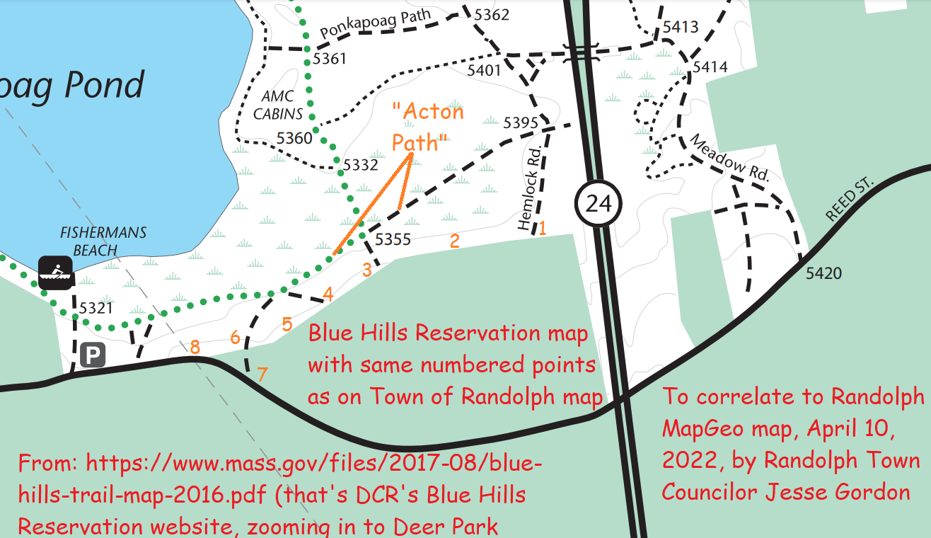
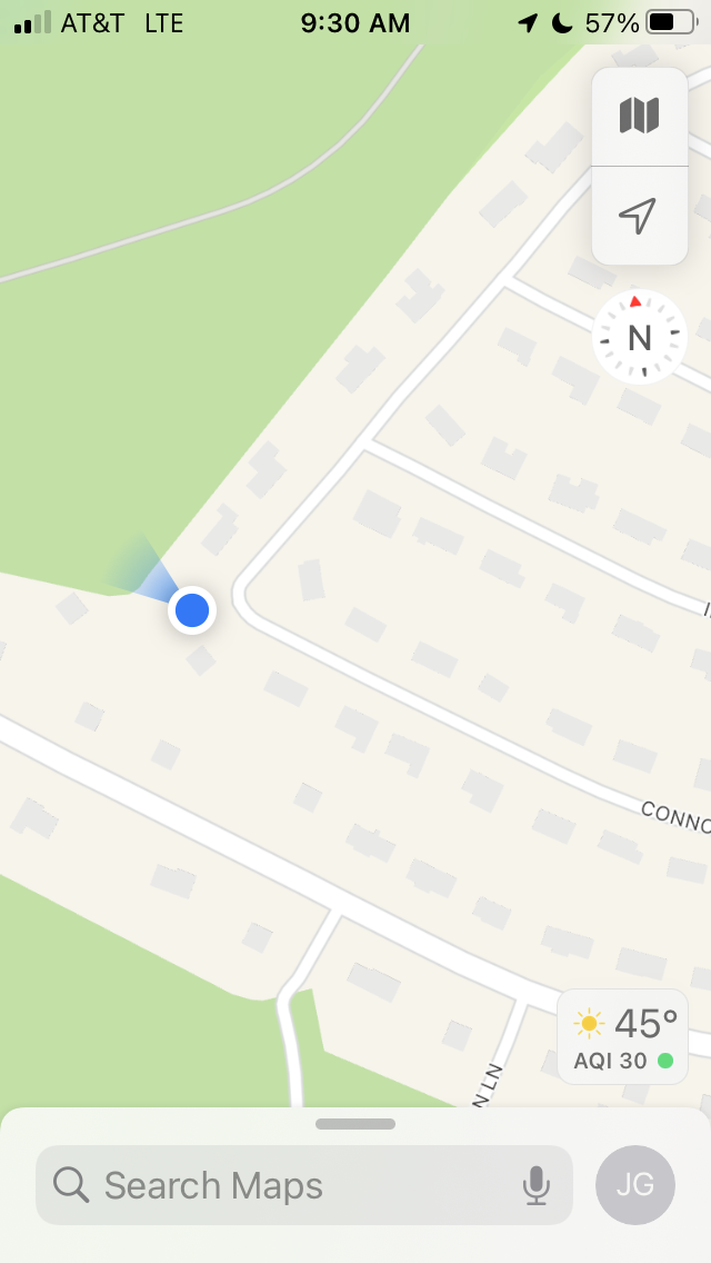
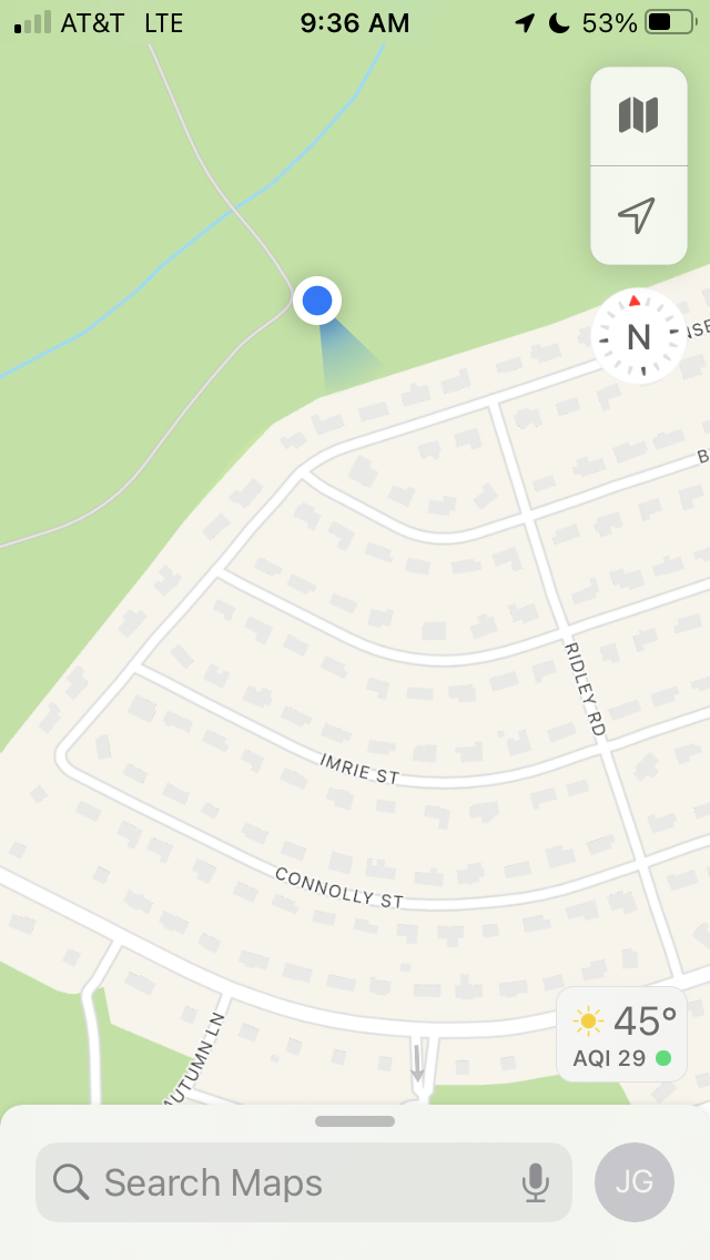
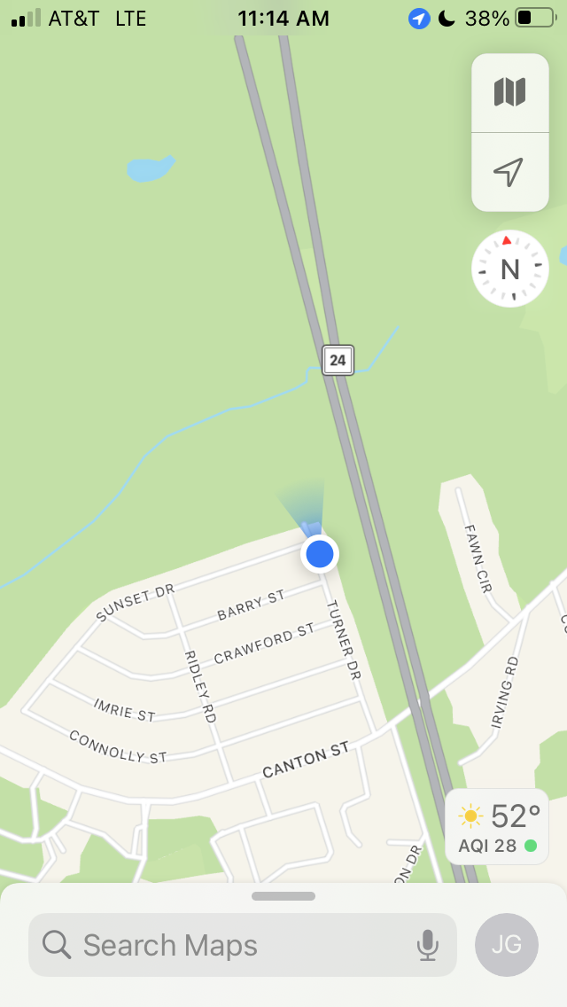
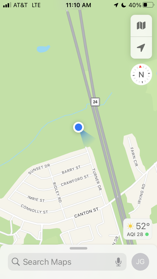
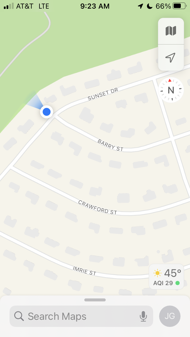
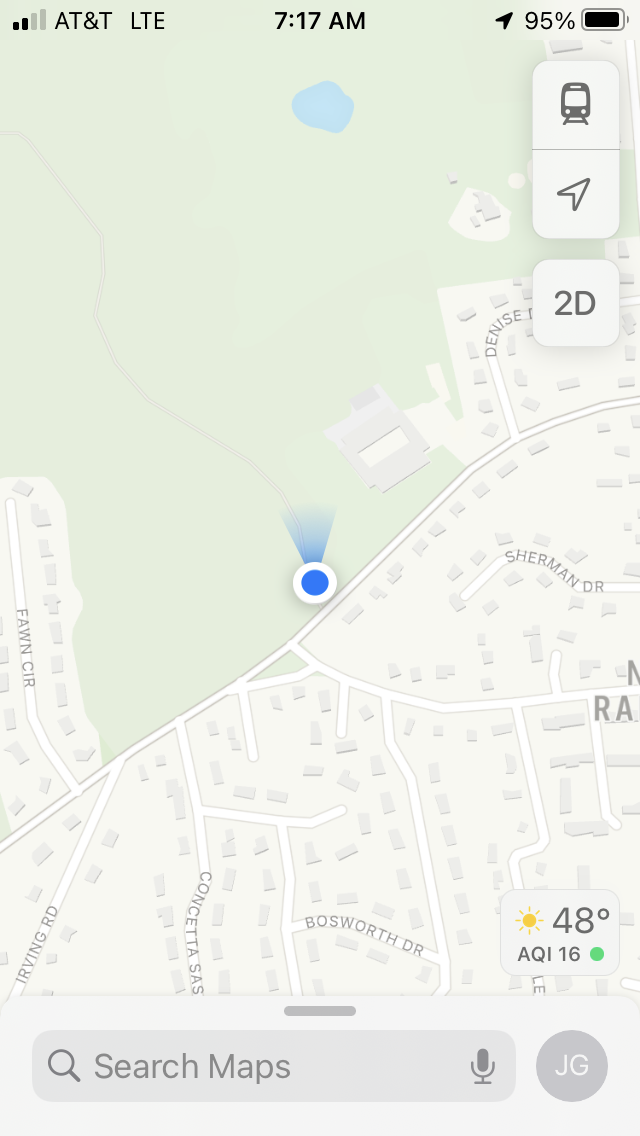
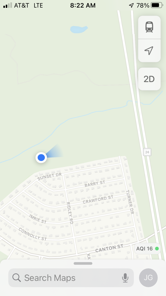
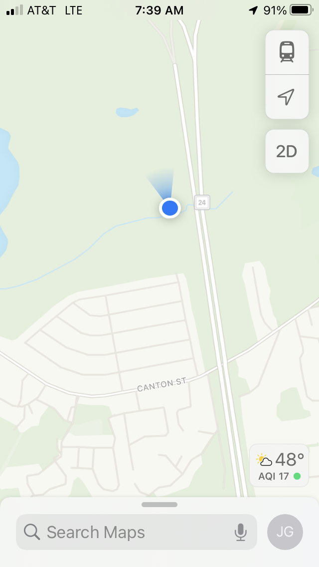
Here's a map of the four "spur trails" that border Deer Park in Randolph. The points marked 1, 2, 3, 6, and 8 are where trails from the state park meet right-of-way entrances in Randolph. Councilor Gordon will work to clarify what connects to where -- it's not so clear!
POINT 8: This trail is at the westernmost edge of Randolph, right near the Canton border. The trail leads out to Canton Street -- we should add a sidewalk there and then it's within walking distance of Prynne Hills and thousands of residents!
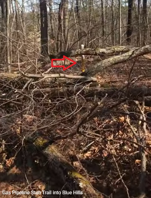
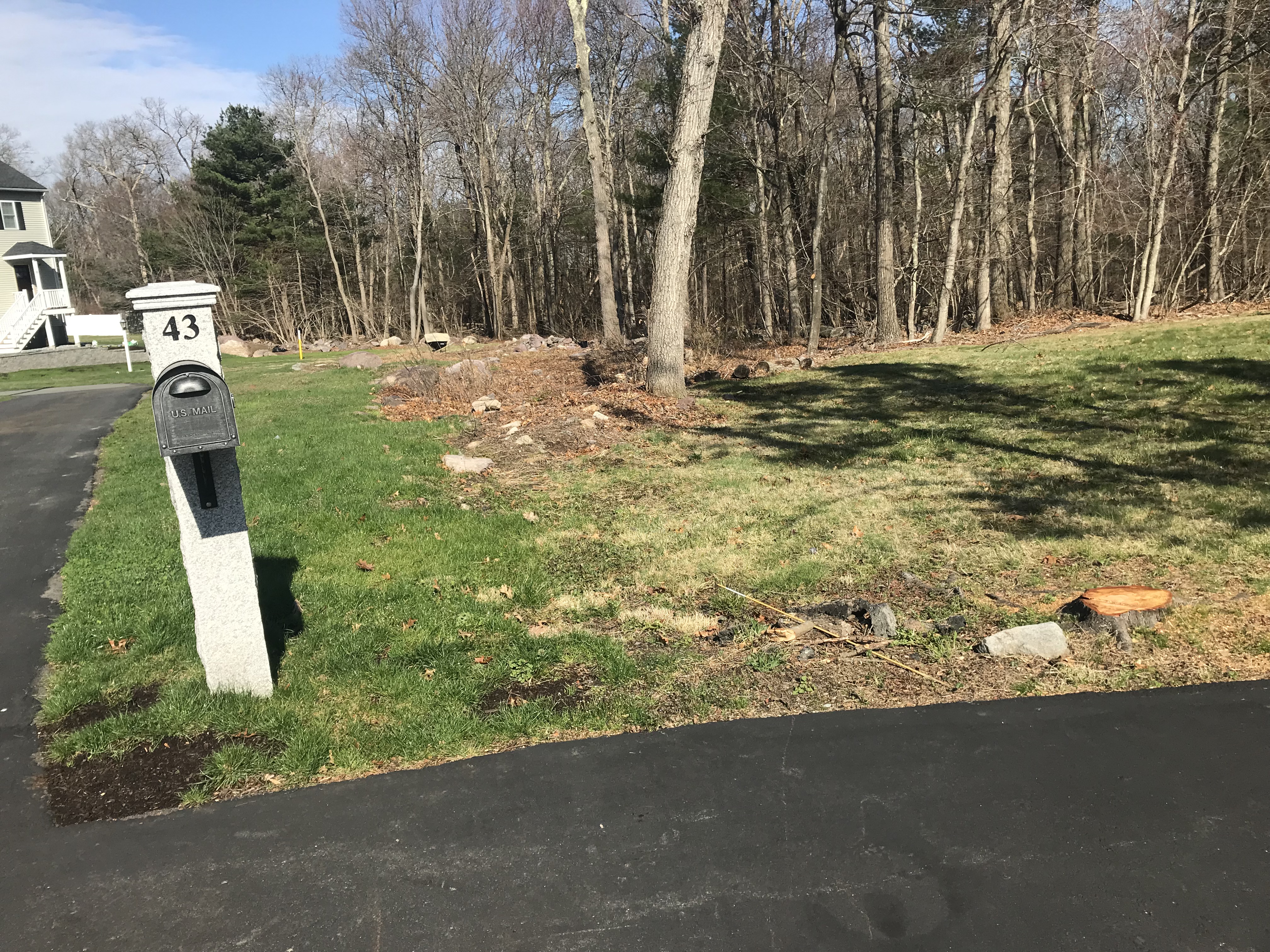
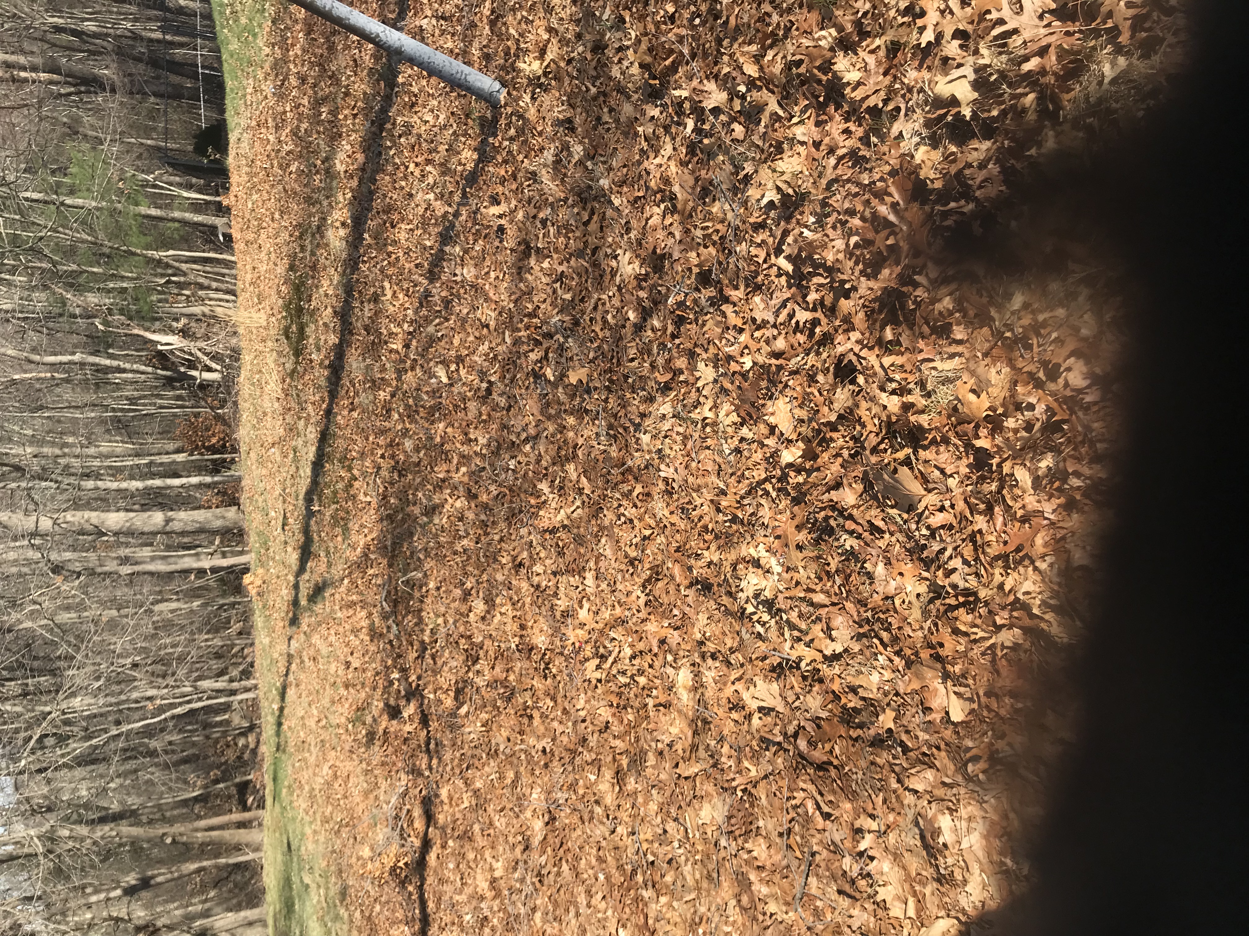
POINT 6 to POINT 7: This "gas pipeline" trail connects Acton Path in the Blue Hills Reservation to Sunset Drive in Randolph's Deer Park neighborhood. It has yellow-and-white "gas pipeline" markers on it; it connects to Randolph at the corner of Connolly Street and Sunset Drive.
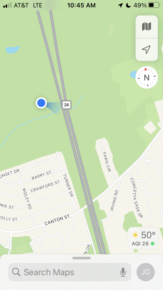
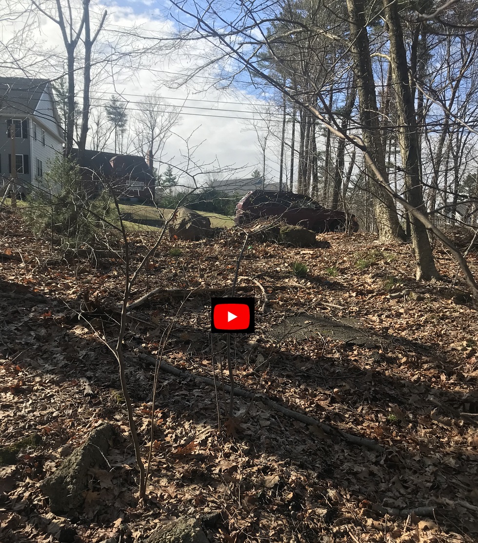
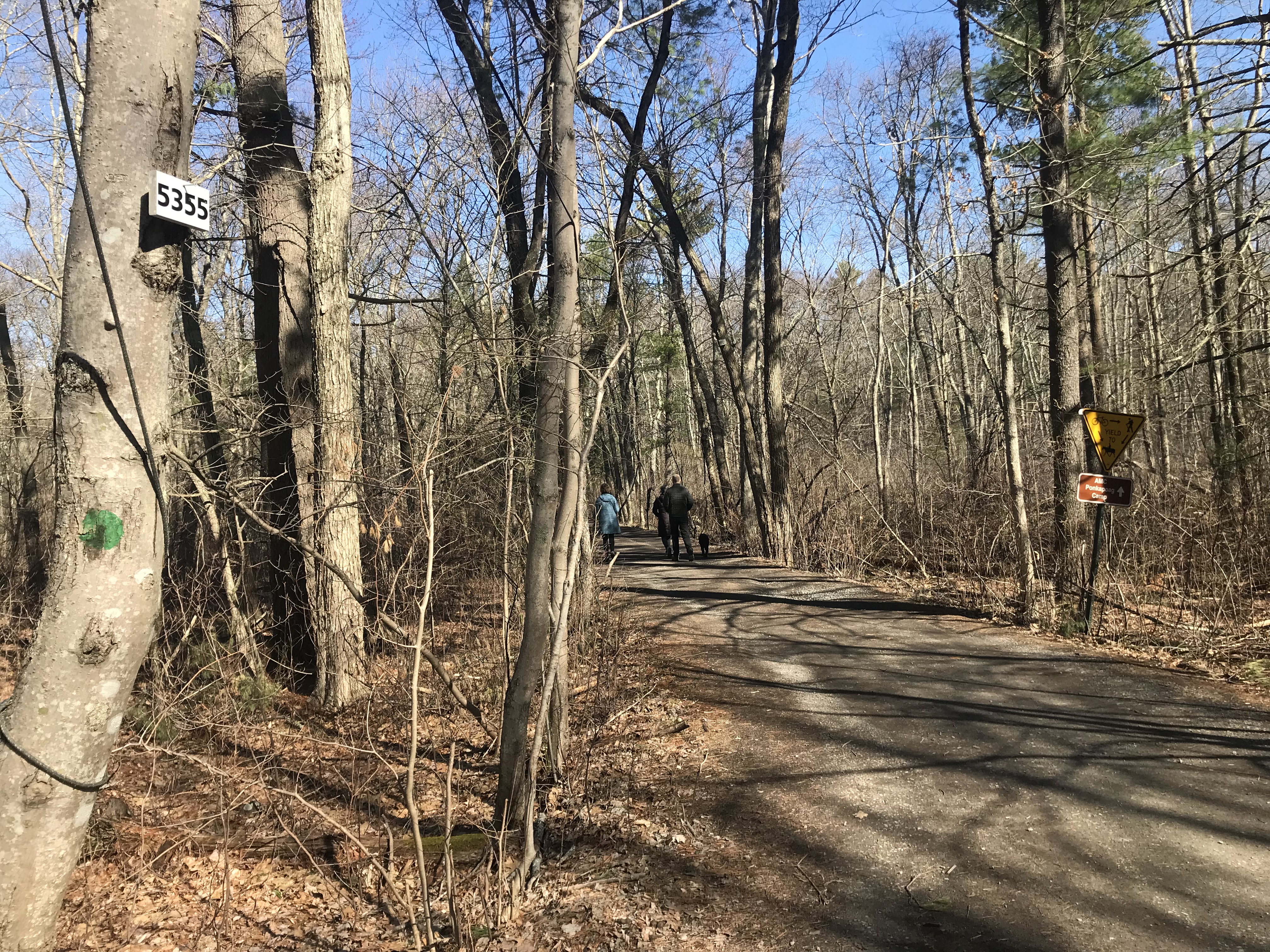
POINT 2: This trail isn't on the Blue Hills map -- it parallels the Acton Path and connects at trail marker 5355. I think it's where the electrical wires come in for the AMC huts -- which means the electric company maintains it (and we can use it!)
Video of Electrical wire trail at eastern end of Sunset
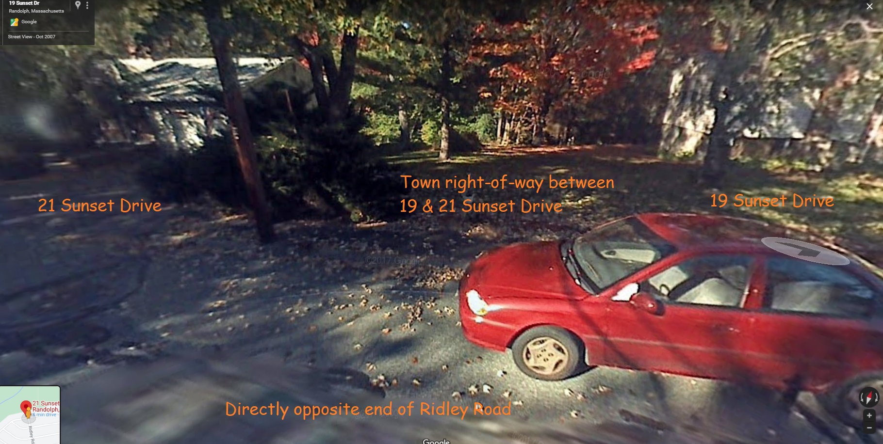
POINT 3: The dead end of Barry Road (across Sunset Drive) is a public right-of-way from Randolph into the Blue Hills Reservation. Councilor Gordon proposes to add "Welcome" signs for pedestrians on the Randolph side, and to clear the trail on the Blue Hills side, to allow hundreds of Randolph residents to walk to enjoy the state park.
Drive-by tour with Kathleen Camara then bike to three locations for trail maintenance
Meadow Road
Report on Donovan School entrance: "Meadow Road" from Reed Street Randolph between markers 5420 & 5414 --
Tree blocking Reed Street entrance has been removed (cut fallen tree)
We cleaned up litter near the Donovan parking area -- all the little entrance trails are heavily used so I'll do litter pickup regularly!
I got funding from the Randolph CPC for signage at this entrance -- to apply at our discretion using DCR signage guidelines -- the Donovan parking area is first priority!
Funding for signage also applies to High Street "baseball field" entrance -- biked from Donovan to that entrance -- could use some input on best location for sign (maybe at the snack stand? a grassy entrance).
Remaining Work:
Work with the Town of Randolph to place CPC-funded signage on Town property adjacent to the Blue Hills property at Donovan School and on High Street.
The gas line trail to Sunset Drive still has a fallen tree blocking it which DCR should cut up. People can (and do) walk around the tree but it makes it look uninviting.
We picked up litter all along these trails - which shows they are being used -- we left untouched in place several garbage bags near Sunset Drive -- which shows it is being abused too.
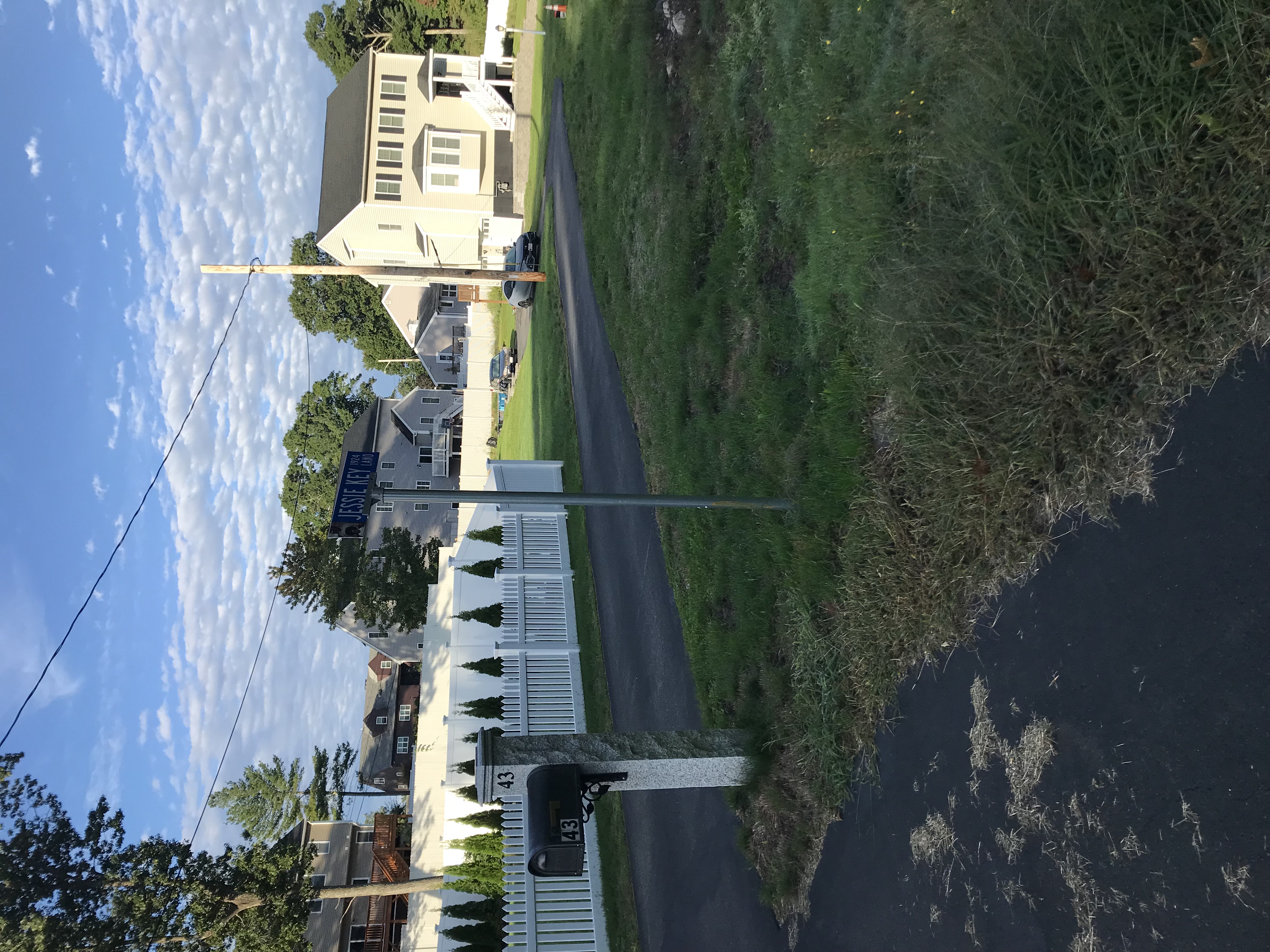
The street entrance to the gas line trail (intersection Sunset Drive and Connolly Street) is called "Jessie Key" -- I will check with Town of Randolph where exactly are the property lines -- this could be a nice neighborhood pedestrian entrance (but DCR looked with Judy and thought it was too residential, so I didn't include it on CPC funding list -- it'd be for next year)
Remaining Work:
The gas line trail to Sunset Drive still has a fallen tree blocking it which DCR should cut up. People can (and do) walk around the tree but it makes it look uninviting.
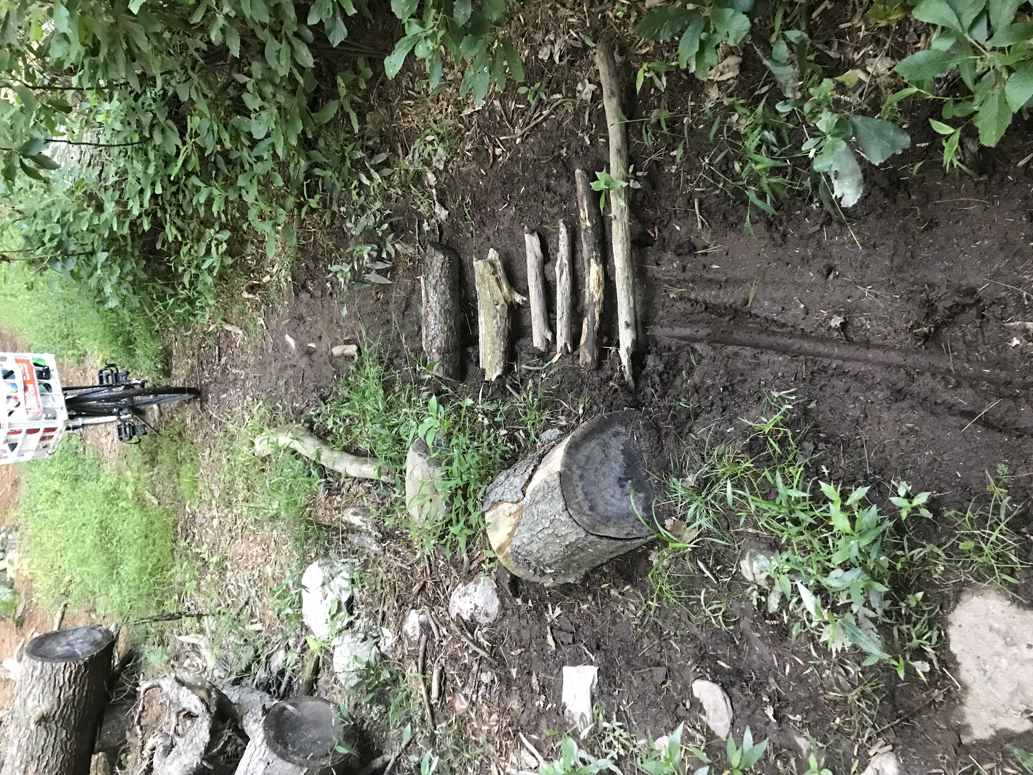
Report on Hemlock Road (the extension of Turner Drive northward past the dead end):
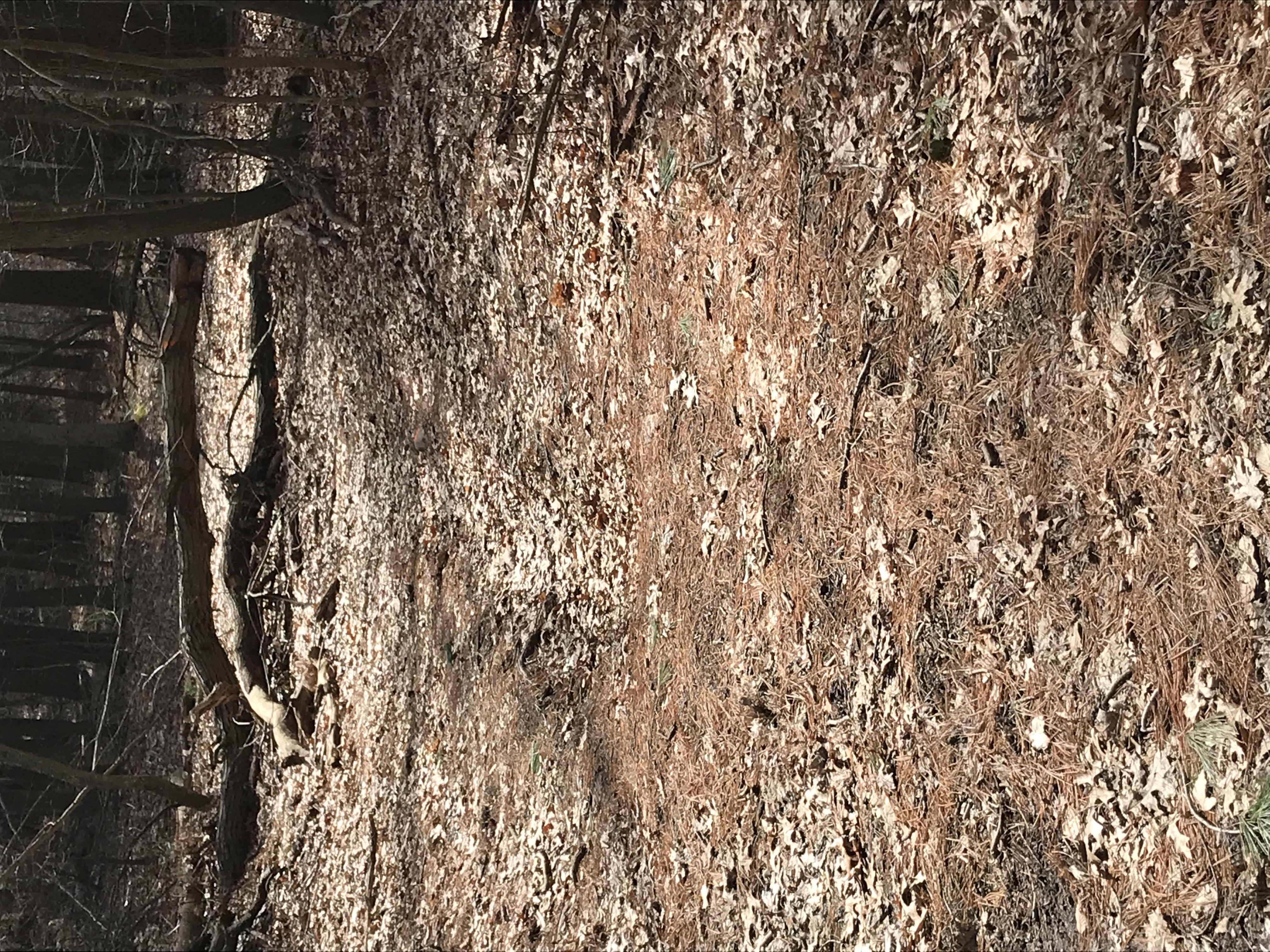
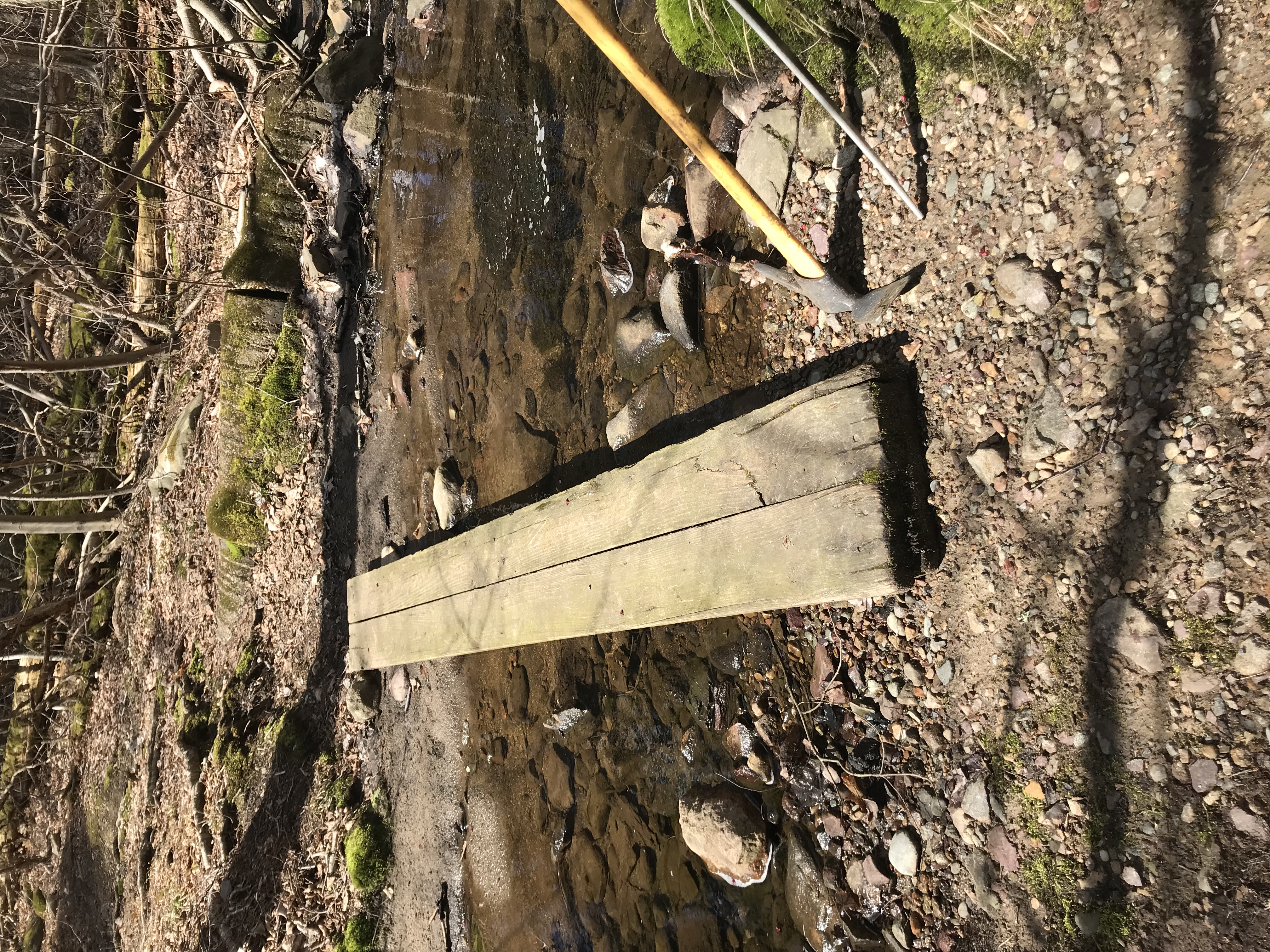
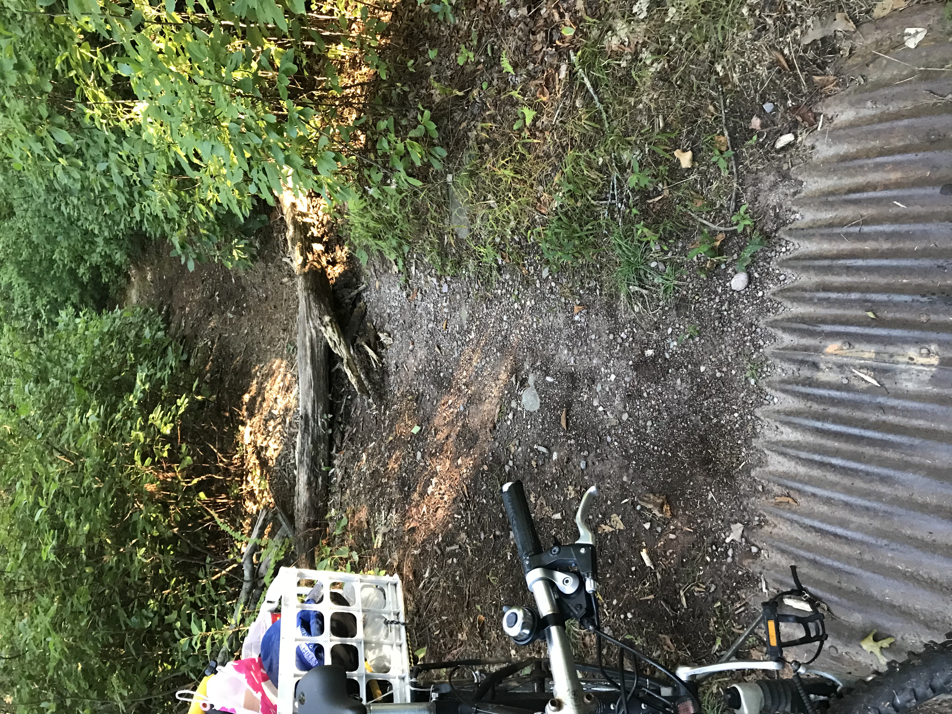
See IMG_6506 & IMG_6507 - Worked on one barely-passable mud spot (actually north of my adopted section) -- someone tried to help on this little mud spot -- we added a few more sticks and then fetched 20 lbs of bluestone gravel from the Acton Path leftovers - I don't think this is the recommended action here -- could someone advise me? The bicycle tracks are not ours -- others DO bike here!
We picked up litter all along these trails - which shows they are being used -- we left untouched in place several garbage bags near Sunset Drive -- which shows it is being abused too.
We also patched several "potholes" on Acton Path for the horses to avoid tripping. DCR did a nice job delivering the bluestone gravel in the spring and "patching" the big dips in the summer -- there was a leftover pile along Acton Path so we distributed 100 lbs of it.
Remaining Work:
See IMG_6505 -- I brought a saw to cut this log (I had started in spring) but it needs better tools. Like an axe and a two-person saw -- which I'll bring next time.
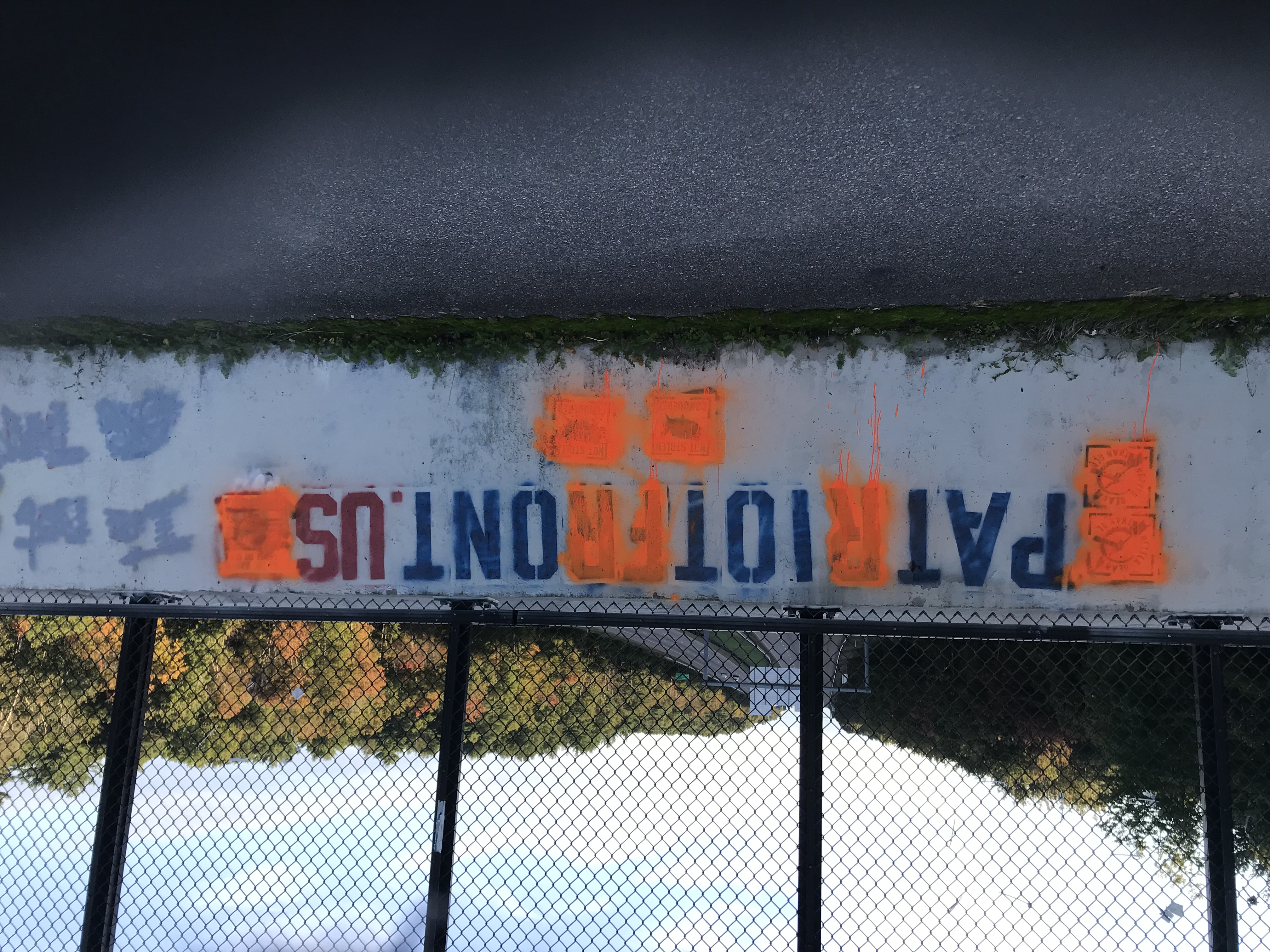
See IMG_6502 -- This is a white supremacist group "stenciling" the Horse Bridge. I reported this to the Randolph DPW to ticket them for defacing public property, and I recommended to the ADL that we prosecute the group for publicly advocating violence. Their website indicates that they have stenciled this same hate message all over Massachusetts -- I will follow up with other Town Councilors in other targeted towns to try to jointly prosecute. I asked DPW if they could paint this over -- maybe DCR can? (I will paint over it myself, if not done quickly).


